
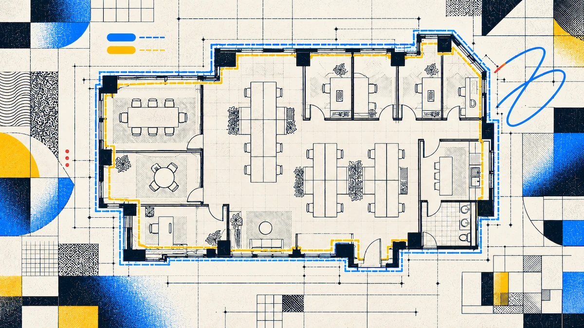
A commercial listing’s floor plan and the lease’s square footage are not the same thing. The floor plan helps prospects see how the space is laid out. The square footage is calculated using a measurement standard, and in office leasing, the BOMA standard is usually used to figure out Rentable Area.
You can create a floor plan in an afternoon using a phone scan. To get the official area figure, you’ll need a measurement professional. This guide explains how to make a floor plan for a commercial lease listing with Polycam, when to use Pix4D for bigger projects, and how to avoid putting scan measurements where they shouldn’t go.
Key Takeaways
- Polycam lets you scan with a LiDAR iPhone or iPad and quickly create an editable 2D or 3D floor plan right on your device. You can export your plan as a PDF, PNG, SVG, or layered DXF file.
- Pix4D's indoor workflow produces a 3D point cloud, not a drawn plan. It suits very large floors and survey-grade projects with a CAD drafter on the team.
- Scan accuracy can change in spaces larger than 5,000 square feet or near glass and shiny floors. Always double-check important measurements while you’re still on site.
What a Commercial Lease Listing Floor Plan Needs to Show
Before anyone visits, a prospect’s broker and architect will review the floor plan. They check for the suite’s boundaries and entrances, window lines, columns, fixed rooms like restrooms and server closets, and the overall size. Every version should include a north arrow and a note that dimensions are approximate.
The listing should have an image or PDF of the floor plan. The tenant’s architect will need a CAD file to test the fit. Polycam can export both types from the same scan.
What You'll Need
- You’ll need a LiDAR-enabled iPhone or iPad to capture the floor plan.
- Polycam’s Business plan, which costs $400 per user per year, includes floor plans and advanced measurement tools. Annual plans also include a 7-day free trial.
- Make sure you have permission from the owner and, if the suite is occupied, from the tenant. Remember, the scan will capture anything visible, like screens, whiteboards, or paperwork.
Polycam vs. Pix4D for Commercial Floor Plans
| Polycam | Pix4D (PIX4Dcatch + PIX4Dmatic) | |
|---|---|---|
| Built for | Floor plans, measurements, and sharing from one app | Photogrammetry and LiDAR for surveying and construction |
| Output | Editable 2D and 3D floor plan, generated on the device | 3D point clouds and models, with CAD-ready deliverables from desktop software |
| Large spaces | Extend mode for connected rooms, with wider tolerance over 5,000 sq ft | Multiple scans merged with printed Autotag targets |
| Extra steps to a plan | Review, label, export | Process, merge, then draft the plan in CAD |
| Best fit | Brokers, landlords, property managers, TI contractors | Survey and VDC teams, whole buildings, georeferenced projects |
When scanning large interiors, positional errors can build up. This is a phenomenon called drift. To help adjust for this drift, Pix4D recommends that you place printed Autotags around the space. In their test, a phone with tag detection had an average error of 7 pixels, compared to 41 pixels without tags. Using this method, Pix4D mapped a 2,000-square-meter office with five merged scans and about 5,000 photos.
The result is a merged point cloud in PIX4Dmatic, Pix4D’s desktop software. To turn this into a floor plan for a listing, someone still needs to trace the walls in CAD. This approach works well for mapping an entire building, projects that need site coordinates, or teams already using CAD. If you just need a plan for a suite or single floor quickly, Polycam is faster.
How to Make the Floor Plan With Polycam
1. Prepare the space
Turn on all the lights, because low lighting can make the scan less accurate. Glass partitions and polished concrete, which are common in offices, can scatter the sensor’s signal. After scanning, check these areas carefully.
2. Plan your route and begin to scan
ChooseSpace mode if you want both a 3D mesh and a floor plan, or use Floorplan mode for a quicker walk around the perimeter. Stay 3 to 6 feet from surfaces, move slowly, and capture every wall-floor junction and corner.
Plan the order in which you’ll scan the rooms before you start. For example, when I scanned a two-story house without planning, I walked through the main hallway several times, which left unwanted artifacts in the 3D mesh. Office corridors can cause the same problem, since scanning the same spot more than once creates conflicting data.
If you’re scanning a large floor, break it into zones. Measurements are usually more accurate within a single segment than across several, so treat each zone as a separate reference area.
3. Edit and label
The plan will process on your device in just a few minutes. You can rename rooms, adjust walls, edit door and window openings, and remove any furniture you don’t want to show. Switch between metric and imperial units as needed.
4. Verify your capture before you publish
Polycam’s standard interior scans are accurate within about half an inch. This tolerance can get wider if the space is complex or large. Since errors can add up over longer distances, always check the longest measurements with a laser first.
5. Export for each audience
Export a PDF or PNG for the listing and offering memorandum, and use a layered DXF file for importing into AutoCAD or Revit. You can also share a link to the 3D model, so out-of-town prospects can view the space before visiting.
Already Have an Old Plan? Digitize It
Many landlords have a PDF or paper plan from the last build-out. Polycam’sfloor plan digitizer can take JPG, PNG, or PDF files, even photos of printed plans, and turn them into editable plans with walls, doors, windows, and estimated room sizes. This works if the layout hasn’t changed since the drawing was made. If there’s been a build-out, scan the space again.
Square Footage: What the Scan Can and Can't Tell You
TheSpatial Report provides the floor area, room sizes, and ceiling heights for the space you scanned. These numbers help with planning and answering questions from prospects.
Rentable area isn't one of those numbers. The BOMA 2024 office standard, ANSI/BOMA Z65.1-2024, calculates it and covers single-tenant, multi-tenant, and multi-building configurations. A scan of one suite measures what's inside the walls you walked, not a figure calculated under that standard. Publish the plan on the listing, and hire a measurement professional for the lease area.
When scanning large interiors, positional errors can build up. This is a phenomenon called drift. To help adjust for this drift, Pix4D recommends that you place printed Autotags around the space. In their test, a phone with tag detection had an average error of 7 pixels, compared to 41 pixels without tags. Using this method, Pix4D mapped a 2,000-square-meter office with five merged scans and about 5,000 photos.
The result is a merged point cloud in PIX4Dmatic, Pix4D’s desktop software. To turn this into a floor plan for a listing, someone still needs to trace the walls in CAD. This approach works well for mapping an entire building, projects that need site coordinates, or teams already using CAD. If you just need a plan for a suite or single floor quickly, Polycam is faster.
How to Make the Floor Plan With Polycam
1. Prepare the space
Turn on all the lights, because low lighting can make the scan less accurate. Glass partitions and polished concrete, which are common in offices, can scatter the sensor’s signal. After scanning, check these areas carefully.
2. Plan your route and begin to scan
Choose Space mode if you want both a 3D mesh and a floor plan, or use Floorplan mode for a quicker walk around the perimeter. Stay 3 to 6 feet from surfaces, move slowly, and capture every wall-floor junction and corner.
Plan the order in which you’ll scan the rooms before you start. For example, when I scanned a two-story house without planning, I walked through the main hallway several times, which left unwanted artifacts in the 3D mesh. Office corridors can cause the same problem, since scanning the same spot more than once creates conflicting data.
If you’re scanning a large floor, break it into zones. Measurements are usually more accurate within a single segment than across several, so treat each zone as a separate reference area.
3. Edit and label
The plan will process on your device in just a few minutes. You can rename rooms, adjust walls, edit door and window openings, and remove any furniture you don’t want to show. Switch between metric and imperial units as needed.
4. Verify your capture before you publish
Polycam’s standard interior scans are accurate within about half an inch. This tolerance can get wider if the space is complex or large. Since errors can add up over longer distances, always check the longest measurements with a laser first.
5. Export for each audience
Export a PDF or PNG for the listing and offering memorandum, and use a layered DXF file for importing into AutoCAD or Revit. You can also share a link to the 3D model, so out-of-town prospects can view the space before visiting.
Try it on one vacancy. Start a free 7-day Business trial
Already Have an Old Plan? Digitize It
Many landlords have a PDF or paper plan from the last build-out. Polycam’s floor plan digitizer can take JPG, PNG, or PDF files, even photos of printed plans, and turn them into editable plans with walls, doors, windows, and estimated room sizes. This works if the layout hasn’t changed since the drawing was made. If there’s been a build-out, scan the space again.
Square Footage: What the Scan Can and Can't Tell You
The Spatial Report provides the floor area, room sizes, and ceiling heights for the space you scanned. These numbers help with planning and answering questions from prospects.
Rentable area isn't one of those numbers. The BOMA 2024 office standard, ANSI/BOMA Z65.1-2024, calculates it and covers single-tenant, multi-tenant, and multi-building configurations. A scan of one suite measures what's inside the walls you walked, not a figure calculated under that standard. Publish the plan on the listing, and hire a measurement professional for the lease area.








