
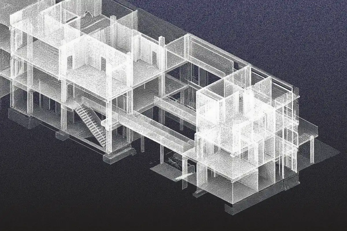
A phone with a LiDAR sensor can produce a measurable 3D record of a building in the time it takes to walk through it. Wall lengths, ceiling heights, window placements, and footprint dimensions: all come from the same capture, without a total station or a survey crew.
What Mobile Scanning Actually Replaces
Mobile LiDAR scanning using an iPhone or iPad Pro captures the geometry of a space as a point cloud or mesh, from which linear dimensions, areas, and heights can be extracted. The advantage over a laser distance meter is not greater accuracy in any single measurement; it's that a single capture session replaces dozens of individual measurements. A contractor can pull wall lengths, ceiling heights, window placements, and floor areas from the same scan before leaving the site.
Mobile scanning accuracy depends on device, lighting, surface type, and capture technique. Highly reflective surfaces, very dark materials, and direct sunlight can degrade scan quality. For work requiring certified dimensional accuracy or legal survey submissions, consult a licensed surveyor.
3D Scanning Apps: What Each One Is Built For
Each app in this space was built for a different end use. Here's what the primary documentation for each one says.
Polycam is a full 3D scanning platform covering Space mode for room and building capture, Object mode for close-range photogrammetry and Gaussian splat capture, and 360 mode for visual walkthroughs. It exports a wide range of formats, including LAS, OBJ, FBX, GLB, USDZ, and DXF, making it the strongest option when the scan data needs to travel downstream into CAD or BIM tools.
Magicplan is primarily a floor plan tool optimized for room-based documentation. Their help documentation describes their AR scan as capable of achieving "a high degree of accuracy" depending on lighting conditions, and recommends connecting a Bluetooth laser meter for 100% accuracy. It outputs floor plans directly and is well-suited to fast interior documentation. It is less suited to exterior capture or point cloud export workflows.
Twindo is a scan-to-CAD service. Their documentation states that most measurements in delivered CAD files should be within 1 to 2% of manually verified dimensions. It is optimized for residential interior scanning and delivers editable CAD files after a processing step. Their documentation notes it is designed for residential-sized spaces, with restrictions in larger commercial or industrial environments.
Scaniverse is a general-purpose LiDAR and photogrammetry scanning app with Gaussian splat support. It supports PLY and SPZ export for splat workflows, as well as LiDAR and photogrammetry modes for structured capture.
RoomScan Pro is a floor plan app by Locometric that supports interior and exterior scanning. It includes LiDAR scanning, touch-wall mode, and exterior scanning via ExteriorScan and PlotScan features. It exports floor plans as DXF, PDF, and IFC, and exports point clouds in PLY, OBJ, and XYZ. It is optimized for floor plan output rather than structured point cloud workflows that feed into BIM or CAD pipelines.
If your downstream need is a CAD or BIM deliverable, Polycam's export range gives it the broadest coverage. For a fast interior floor plan, Magicplan or Twindo may be faster for that specific output.
Interior Measurement Workflow
Step 1: Open Polycam and select Space mode. Space mode uses the device's LiDAR sensor to capture room geometry in real time.
Step 2: Capture the space. (5 to 20 minutes depending on size) Walk the perimeter of each room at a steady pace, keeping the device facing the walls and surfaces you want to capture. Move into corners and along walls rather than sweeping from the center of the room. For multi-room captures, overlap between adjacent rooms by at least two to three meters to ensure continuous geometry.
Pay attention to changes in ceiling height, soffits, and structural elements. The app captures what it sees; if a feature matters to the measurement deliverable, make a deliberate pass to capture it.
Step 3: Review the mesh preview before leaving. (5 minutes) Check the on-device mesh preview for obvious gaps or wall-plane doubling. Wall doubling usually means the device moved too fast in that area, or it scanned multiple times. Re-scan before leaving if the coverage looks thin.
Step 4: Pull measurements from the scan. (5 to 15 minutes) In Polycam, tap any two points on the model to measure the distance between them. You can pull wall lengths, room widths, ceiling heights, door and window widths, and diagonal checks from the same capture.
Step 5: Export for CAD or floor plan use. (5 minutes) Export as DXF for direct CAD import, or as LAS for point cloud workflows.
Exterior Measurement Workflow
Exterior capture with mobile LiDAR has more constraints than interior work. The Canvas support documentation notes that the LiDAR sensor has a range of approximately 5 meters, making it difficult to capture the upper stories of multi-story buildings from ground level. Direct sunlight can also affect scan quality.
Step 1: Plan your capture positions. (10 minutes) Walk the perimeter of the building and identify positions where you can capture each facade at a consistent standoff. Note any areas where access is constrained, surfaces are highly reflective (glazing, polished cladding), or direct sun will hit the facade during your capture window.
Step 2: Capture each facade separately. (10 to 20 minutes per facade) Walk parallel to each facade at a steady pace, capturing from ground level upward. For single-story buildings and the lower portions of multi-story buildings, Space mode captures geometry cleanly. For upper stories beyond the sensor's effective range, a laser distance meter (Bosch GLM or Leica DISTO) can supplement the scan with spot height measurements.
Step 3: Capture corners and junctions. (5 minutes) Move around building corners slowly to ensure the scan registers the junction between adjacent facades. Corner geometry is what allows the overall footprint to be reconstructed accurately.
Step 4: Measure facade dimensions, window placements, and floor-to-floor heights. (10 minutes) Use Polycam's measurement tool to extract horizontal and vertical dimensions from the captured facade geometry. For the overall building height where the upper portion was out of sensor range, supplement with a laser distance meter reading.
Step 5: Export as DXF or LAS for CAD. (5 minutes) See the Scan to DWG guide for the full export walkthrough.
Where Laser Measures Still Win
A dedicated laser distance meter is still faster than mobile scanning for one specific task: a single, precise point-to-point measurement. A Bosch GLM or Leica DISTO gives you a reading almost instantly, and for that single dimension, the accuracy is tighter than mobile.
That changes when you need more than a handful of measurements. A retrofit specialist who needs 30 wall dimensions, ceiling heights, window placements, and structural column locations in the same space can capture all of them in a single scan session. Pulling thirty individual measurements from a laser meter takes significantly longer, and each one is a chance for a transcription error.
Use a laser distance meter for quick single-point spot checks and for dimensions out of mobile range (tall facades, high ceilings in large spaces). Use mobile scanning when you need a spatial record of the whole space that you can return to for measurements later.
Permitting and Acceptance of Mobile Scan Dimensions
The answer varies by jurisdiction and submission type, so it's worth knowing what each category allows before committing scan-derived dimensions to a deliverable.
Mobile scan dimensions are widely accepted for as-built documentation, retrofit planning, space planning, real estate appraisals, and insurance documentation. In these contexts, the practitioner stands behind the accuracy of the work.
For permitted construction submissions, acceptance depends on the local building authority. Some jurisdictions accept as-built drawings derived from mobile scanning if prepared and stamped by a licensed architect or engineer. Others require field-verified dimensions for permitted work. Confirm with the relevant authority before relying on scan dimensions for a permit submission.
For heritage building submissions, the ICOMOS Principles for the Recording of Monuments, Groups of Buildings and Sites states that "recording methodologies should, wherever possible, use non-intrusive techniques, and should not cause damage to the object being recorded." Mobile scanning satisfies this principle. Whether scan-derived dimensions are accepted in a specific heritage submission depends on the scope and the reviewing body.
For boundary surveys, setback certifications, or other legally certified dimensions, a licensed surveyor using calibrated equipment is required. Mobile scan dimensions do not substitute for certified survey work.
Exporting Measurements to CAD
Polycam exports DXF files directly, which can be imported into AutoCAD, Revit, Civil 3D, and most other CAD applications. The DXF export from a Space mode capture includes the geometric outline of the scanned space, from which walls, openings, and structural elements can be traced or referenced.
For a full walkthrough of the DXF export process and CAD workflow steps, see our Scan to DWG guide.
For point cloud workflows feeding into Revit or Civil 3D, export as LAS and convert via Autodesk ReCap. See our Point Cloud Export Formats guide for guidance on format selection, and our How to Create As-Built Drawings guide for the full as-built workflow.
FAQ
How do you measure a building exterior with a phone? Open Polycam in Space mode and walk each facade at a standoff distance, capturing the geometry of the building's exterior. From the resulting scan, you can extract horizontal dimensions, window placements, and lower-story heights using Polycam's measurement tool. For upper stories beyond the LiDAR sensor's effective range, supplement with a laser distance meter for height measurements. Export as DXF for CAD, or LAS for point cloud workflows.
What are the best apps to measure floor area from photos or scans? For floor area measurement from a 3D scan, Polycam in Space mode captures full room geometry from which floor area can be extracted. Magicplan is optimized specifically for floor plan generation and describes its AR scan as capable of achieving a high degree of accuracy depending on lighting conditions, per its help documentation. Canvas (now Twindo) delivers editable CAD files with measurements within 1-2% of manually verified dimensions, according to their documentation. The right choice depends on whether you need raw scan data for downstream CAD work (Polycam) or a fast floor plan output (Magicplan or Twindo).
What are the alternatives to LiDAR scanners for building measurements? The main alternatives are photogrammetry (using overlapping photos to reconstruct geometry, available in Polycam's Object mode and in apps like Scaniverse), manual measurement with a laser distance meter (Bosch GLM, Leica DISTO), and total station survey for certified dimensions. Mobile LiDAR scanning sits between photogrammetry and total station work in terms of speed and accuracy: faster and less equipment-intensive than a total station, more structured and measurable than photogrammetry for simple interior spaces.
How do I get accurate wall lengths from a scan? Capture the space in Polycam's Space mode, then use the in-app measurement tool to tap two points on the wall and read the distance. For best results, check that the wall plane is captured cleanly by walking slowly along it during the scan. Check the mesh preview for any doubling or gaps along the wall before leaving the site. For single critical dimensions, verify with a laser distance meter.
Can mobile scan dimensions be used for building permits? It depends on the jurisdiction and the type of submission. Scan-derived dimensions are widely accepted for as-built documentation and appraisal work. For permitted construction submissions, acceptance varies by local building authority. Some jurisdictions accept scan-derived drawings when prepared and stamped by a licensed architect or engineer. Confirm with your local authority before relying on scan dimensions for a permit submission.
How do you measure heritage buildings without contact? Mobile LiDAR scanning is a non-intrusive documentation method that works well for heritage structures where physical measurement is restricted or where contact with the building fabric is not acceptable. The ICOMOS Principles for the Recording of Monuments, Groups of Buildings and Sites states that recording methodologies should, wherever possible, use non-intrusive techniques and should not cause damage to the object being recorded. Polycam's Space mode captures geometry without physical interaction, and the scan can be referenced for dimensions indefinitely without returning to the building.
How do you measure a building's footprint from a scan? Capture the exterior perimeter of the building in Space mode, walking each facade and rounding each corner to ensure continuous geometry. Export as DXF and open in CAD to trace the floor plate outline. The footprint area can be calculated directly from the traced geometry. For buildings with complex footprints or significant facade setbacks, break the capture into multiple sessions and review coverage before leaving the site.








